There are very few written records from the early period of the area of what is now the Municipality of Viškovo. However, the remains of Illyrian forts on the hills and the traces of the Limes boundary wall in Marišćina Forest attest to the fact that this area has been inhabited since ancient times.
The northern part, which is the largest in size, is called Halubje and is located at an altitude of 400 m. The name comes from the word halupa, meaning shepherd’s hut, which reflects the local tradition of shepherding – the area’s main activity until the 19th century. After the industrial boom and increased need for milk in the neighbouring city of Rijeka, the inhabitants of Halubje turned from sheep to cow farming. Due to the scarcity of arable land and an unfavourable climate for growing more demanding crops, each family cultivated small plots of land to provide enough food for themselves. They grew potatoes, beans, cabbages, turnips, carrots, peas, corn and vines. Men burned charcoal in the forests, and the women carried it together with the milk to Rijeka and Opatija to sell it.
The southern part of the Municipality of Viškovo (the area from Furićevo to Marinići) is called Gornja Smokvarija, the name of which is derived from the Croatian word for fig (smokva), revealing that this area, located at an altitude approximately 100 m below Halubje, once had more favourable conditions for growing crops, especially fruit. In addition, due to the proximity of Rijeka, its inhabitants could work in the city’s factories.
From the Middle Ages until the mid-20th century, this area was part of the Kastav Commune, which was ruled by the feudal lords of the Devin, Walsee and Habsburg families. The administrative centre was the town of Kastav. For hundreds of years, the relevant law was the Law of the Town of Kastav, which dates back to 1400 and is one of the oldest legal documents written in the Croatian language.
The development of this area is connected to the construction of the road towards Italy, Austria and other European countries. Historical records from the 16th century mention that a road which connected Rijeka and Ljubljana passed through what is now Viškovo. Inns, forges and other facilities were opened along this road.
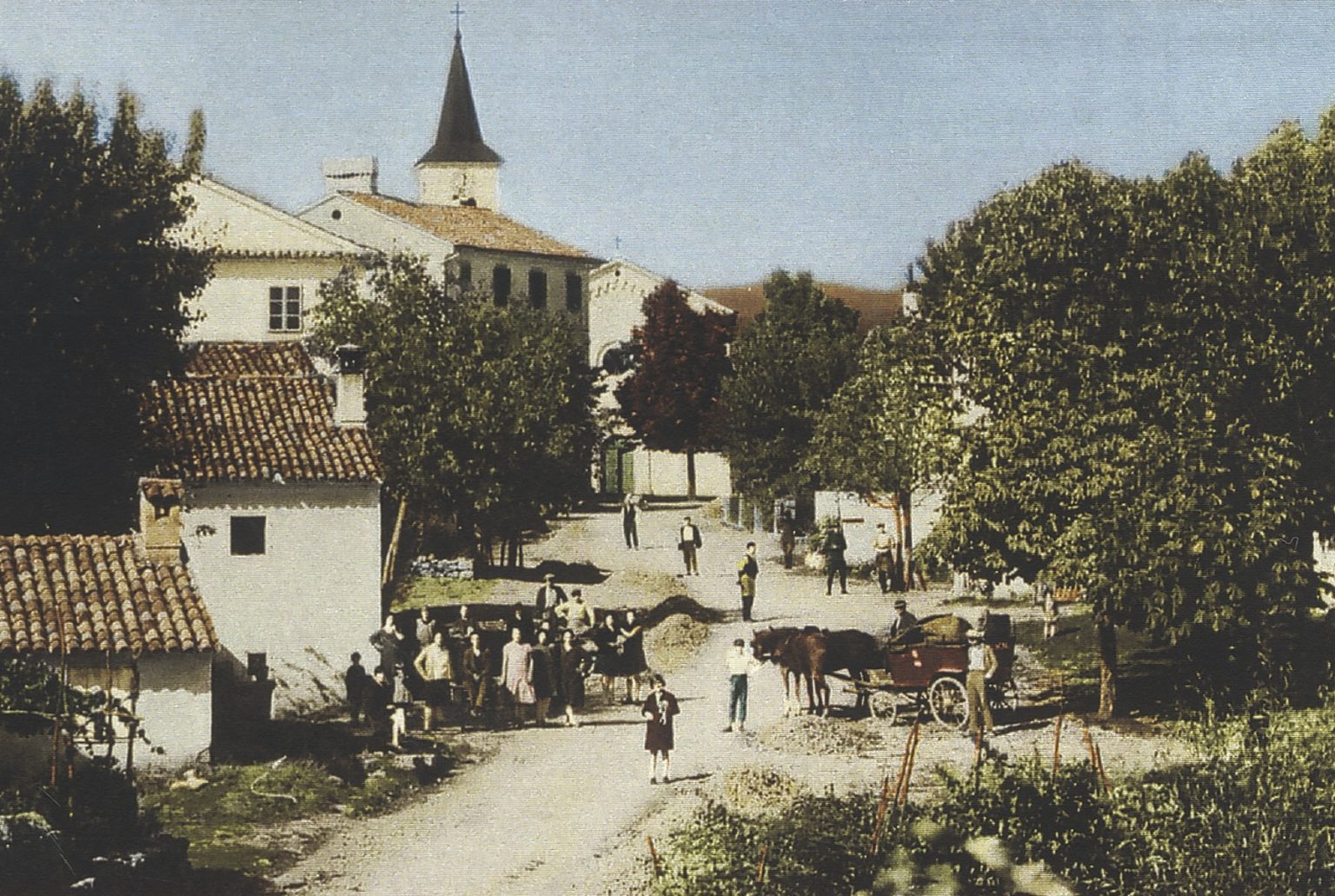
Historians believe that Viškovo emerged in the 18th century on a hill called Viškov Breg, which was the original name of the settlement. After the construction of the small chapel of St. Matthew, the village was named Sveti Matej. This name was first recorded on an Austrian map from the period between 1763 and 1784. A church dedicated to the same saint was erected on the location of the chapel in 1862 and consecrated in 1865.
An article in Nova Sloga newspaper in 1892 depicts Sveti Matej in the following manner:
Sveti Matej is a small but lovely village built on a small hill, and is known as Viškov Breg by the locals. I do not wish to praise it, but it must be admitted that it is one of the most beautiful villages in the Kastav area. It has nice spacious houses and there is also the impressive Church of St. Matthew and a school building. The latter is located on the most attractive spot in the village.
The newspaper also gives an account of Viškovo in the 18th century during the reign of Maria Theresa:In the middle of the village, there is a water well with an imperial coat of arms on it. It was built by the Empress Maria Theresa so that the soldiers who passed through this area could have fresh water. The well is nicely constructed, and its opening is made of wrought iron and it is equipped with a pulley to raise water. The well is located in a district which is, together with the school building, now part of the municipality. Right next to the village, there is an attractive spacious cemetery and the Church of St. Rochus.
Viškovo